
Desert Shores Master Plan Community
June 24, 2019
Best Museums in Las Vegas
June 25, 2019Red Rock Canyon in Las Vegas
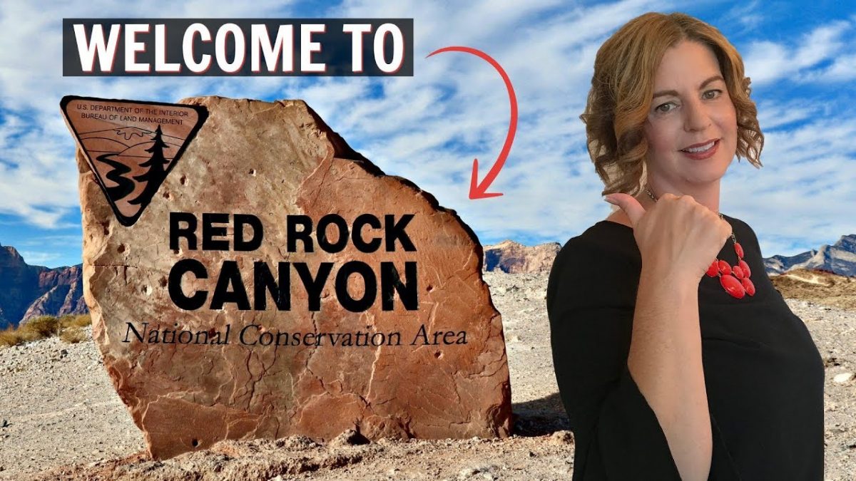
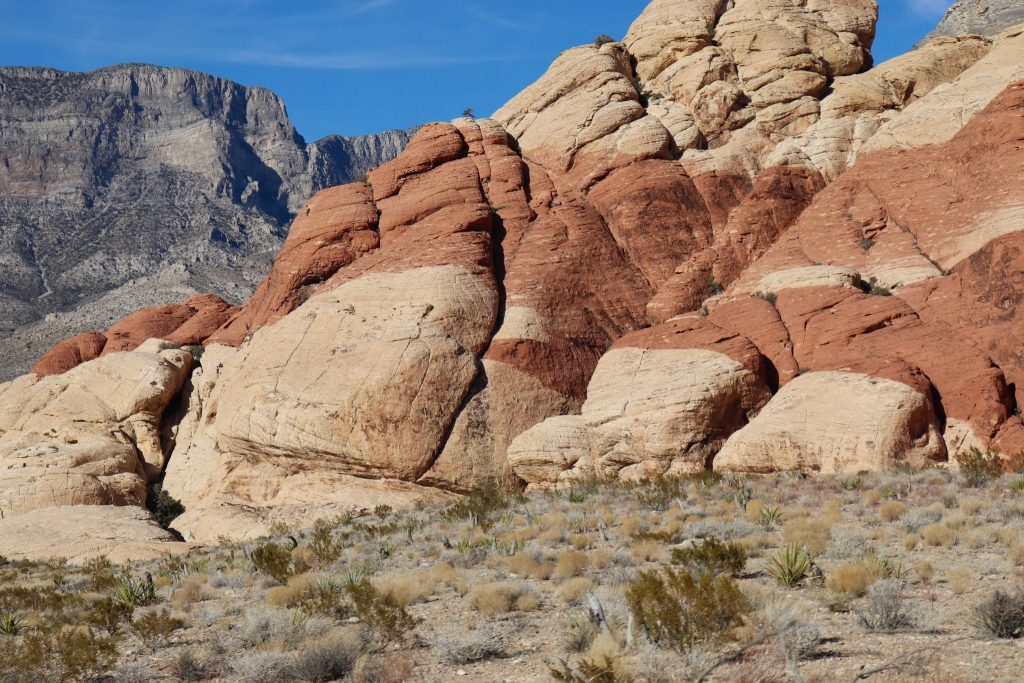
Red Rock Canyon National Conservation Area
Red Rock Canyon National Conservation Area. In addition to this fantastic scenery, Red Rock Canyon offers some of the best hiking, rock climbing, biking, and outdoor recreation activities in the region.
Red Rock Canyon is located 17 miles west of the Las Vegas Strip on Charleston Boulevard and encompasses 200,000 acres within the Mojave Desert.
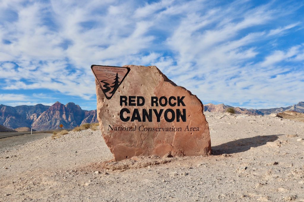
Red Rock Canyon National Conservation Area
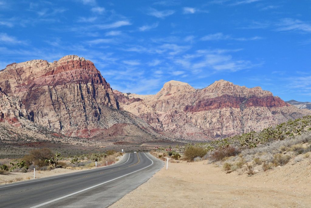
FIRST STOP – VISITOR CENTER
Be sure to stop by the Red Rock Canyon Visitor Center before you start your day. The Scenic Drive will not return you to that area, so you don’t want to miss it! The Visitor Center is an informational hub for visitors filled with indoor and outdoor exhibits, plant specimens from throughout the canyon, and live Desert Tortoise habitats.
Chat with the Information Desk about hike recommendations, participate in a program, and pick up something at the Elements shop to remember your trip. The one-way 13-mile Scenic Drive through Red Rock allows visitors to explore the highs and lows of the canyon from their vehicle or bicycle, with many scenic stops and trailheads along the way.
Entrance fees support visitor facilities and upkeep for this world-renowned scenic drive. A one-day pass costs $15 per vehicle or you can purchase an annual pass for $30 per person.
Red Rock Canyon is a maze of canyons and peaks, ledges and chimneys, chutes and gullies leading to surprises around every wall. There are 26 different hikes and trails that take you from the deep canyons to the highest points of Red Rock canyon.
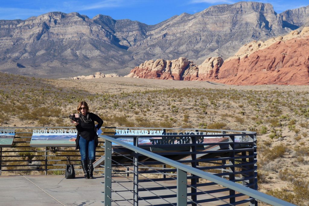
Visitor Center
SECOND STOP – CALICO I
After leaving the visitor center, the Scenic Drive heads straight to the Calico Hills, passing three overlooks and trailheads, Calico I, Calico II, and Sandstone Quarry (the start of Calico Tanks Trail)
Calico I, is the first overlook along the 13-mile Scenic Drive through Red Rock Canyon National Conservation Area. Since the Scenic Drive is a one-way road, Calico I should be your first stop.
If you skip the Calico Hills section and decide you want to see them later, you’ll need to drive all the way around the scenic loop, exit the park, re-enter, and drive back to Calico I.
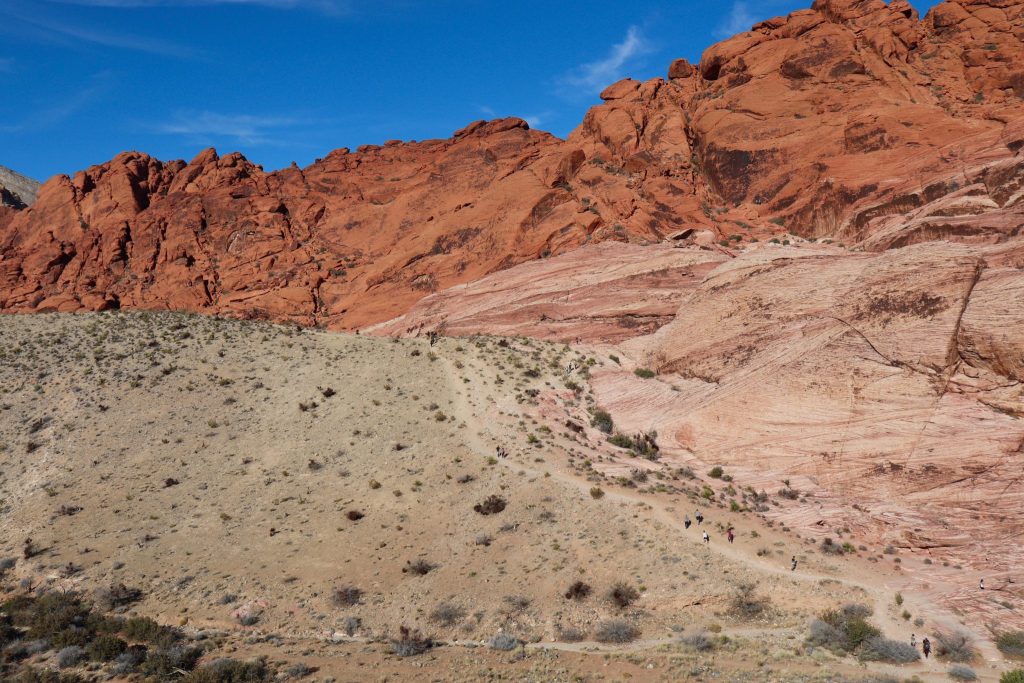
Calico I
NEXT STOP – CALICO HILLS
Calico Hills trail runs along the base of the Calico Rocks from Calico Basin to Sandstone Quarry. Also called Calico Tanks. Distance is variable since the trail can be accessed at either end or from either of the two Calico parking areas.
Calico Tanks Trail is one of the most popular hikes in Red Rock, and for good reason. The trail ventures up a canyon colored in both yellow and red sandstone. This scenic hike is 2.5 miles round trip with 420 feet of elevation change. Most of the trail is easy, but it does have several moderate scrambles up sandstone slopes.
Climbing is becoming increasingly popular in Red Rock. There are routes of interest to both the beginning and advanced climbers. Great boulders and sheer rock faces bring climbers from around the world.
Calico Hills
NEXT STOP – OAK CREEK CANYON
The Oak Creek Canyon Trail can be access from either a small parking area down Oak Creek Road from the Red Rock Canyon Scenic Drive or from a free parking pullout along Blue Diamond Rd. Oak Creek Canyon is one of several beautiful canyons cutting into the Red Rock Escarpment. It receives fewer visitors than other canyons in the area, and the hike has two distinct personalities.
The beginning approach across open desert offers sweeping views of the Red Rock escarpment and the freedom of open desert, and the canyon itself offers challenging hiking over jumble boulders and steep slopes.
Oak Creek Canyon
LAST STOP – CALICO BASIN RED SPRINGS
While the main entrance to Red Rock requires a National park fee, the Calico Basin Red Springs area does not. To get to Calico Basin, head west on Charleston Blvd. and its about 1.5 miles before the entrance to the Scenic Loop of Red Rock.
The area features spectacular red and white sandstone cliffs and, as the name implies, there are many natural springs that feed the abundant vegetation and attract a variety of interesting wildlife. Calico Basin is a colorful area tucked between the gray limestone La Madre Mountains to the north, the red sandstone Calico Hills to the west, and a desert ridge to the south.
Calico Basin has a wide variety of short routes. There is a mixture of traditional and sport climbs. Calico Basin is a residential area, so climbers should be careful to avoid disturbing the people who live there.
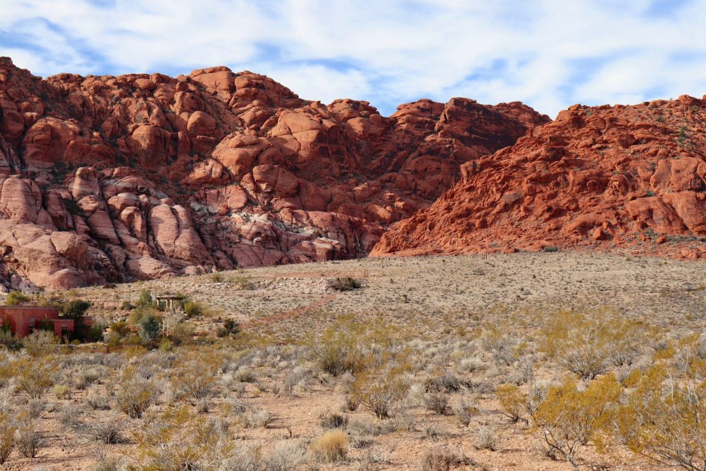
Calico Basin
Check out my BLOG on why you should move to Las Vegas!
Subscribe to our YouTube Channel: http://bit.ly/YouTubeOHare


